GAC aerial photographs & maps
* Google earth aerials of site 1997-2011
Use Back Button to Return Here
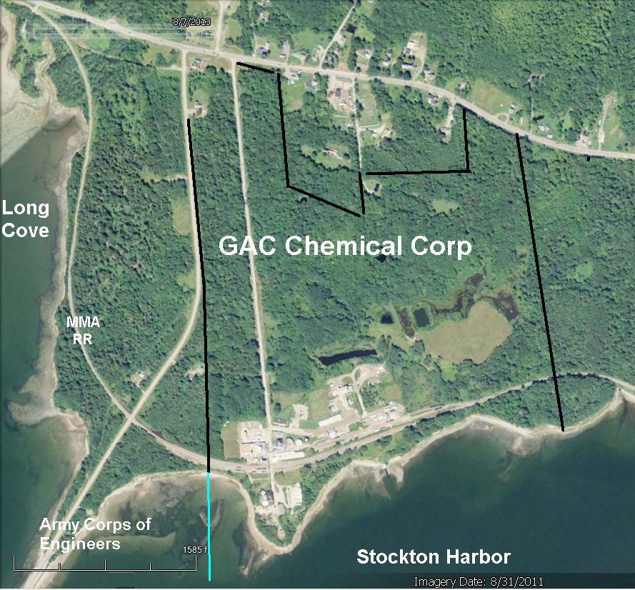
* 2011 GAC Chemical aerial w/company property lines.
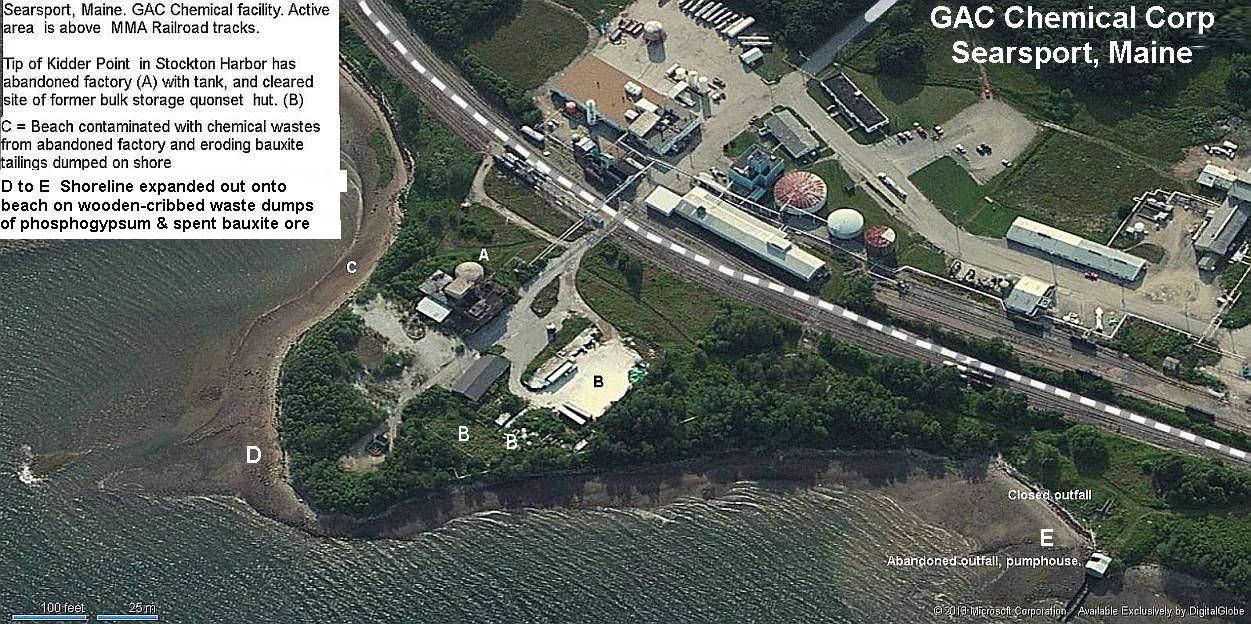
* Kidder Point waste fill areas
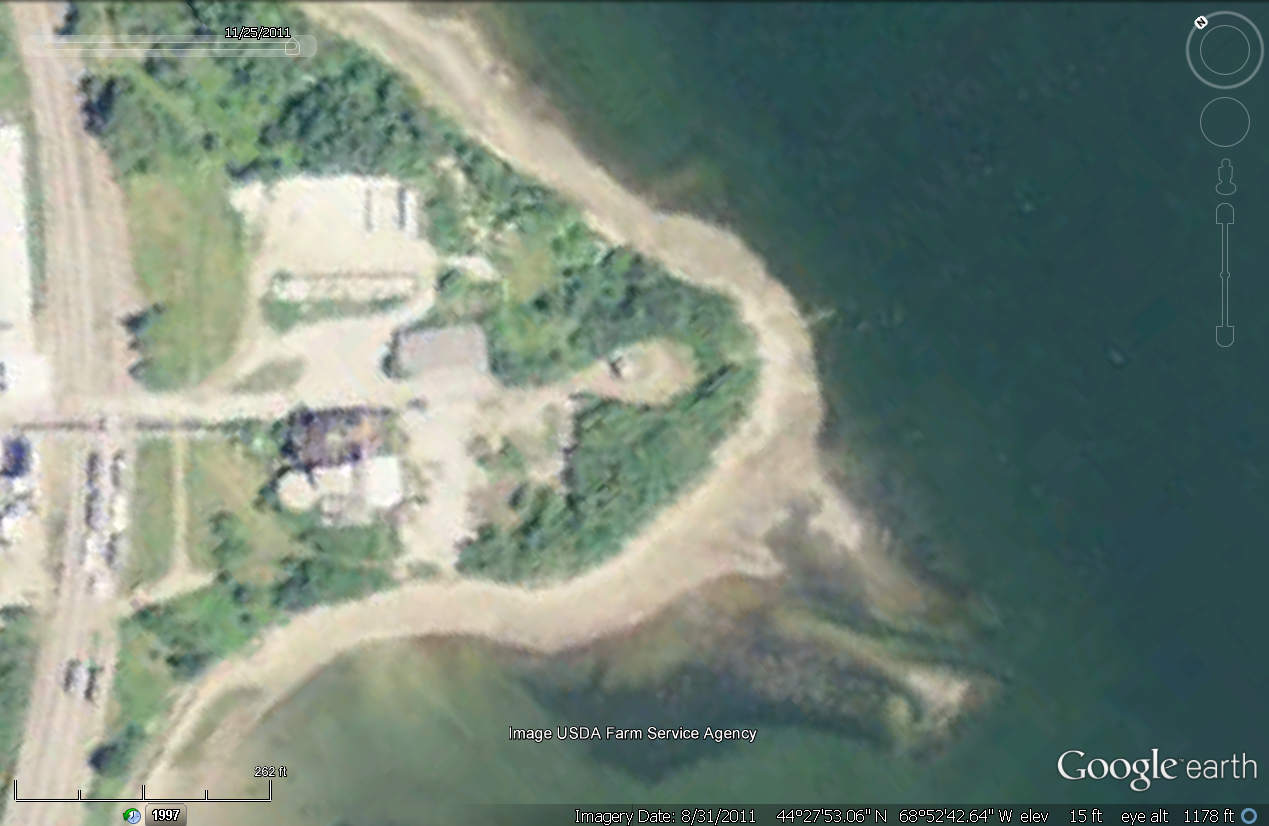
* 2004 Aerial with now-razed fertilizer-then-bauxite quonset hut. ***
w/o quonset hut (2011).