Back to Penobscot Bay Blog
***Back to Friends of Penobscot Bay
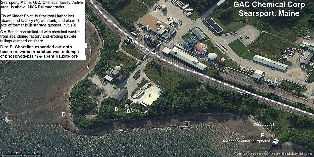
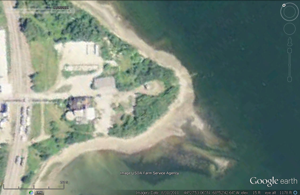
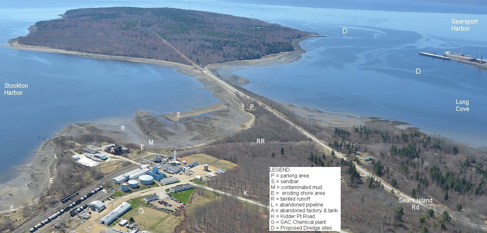
Kidder Point Legacy Shoreline Waste Remediation Project.
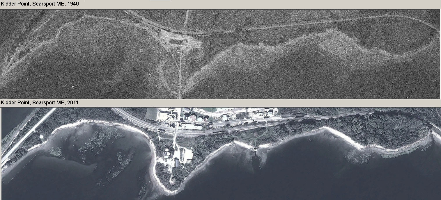
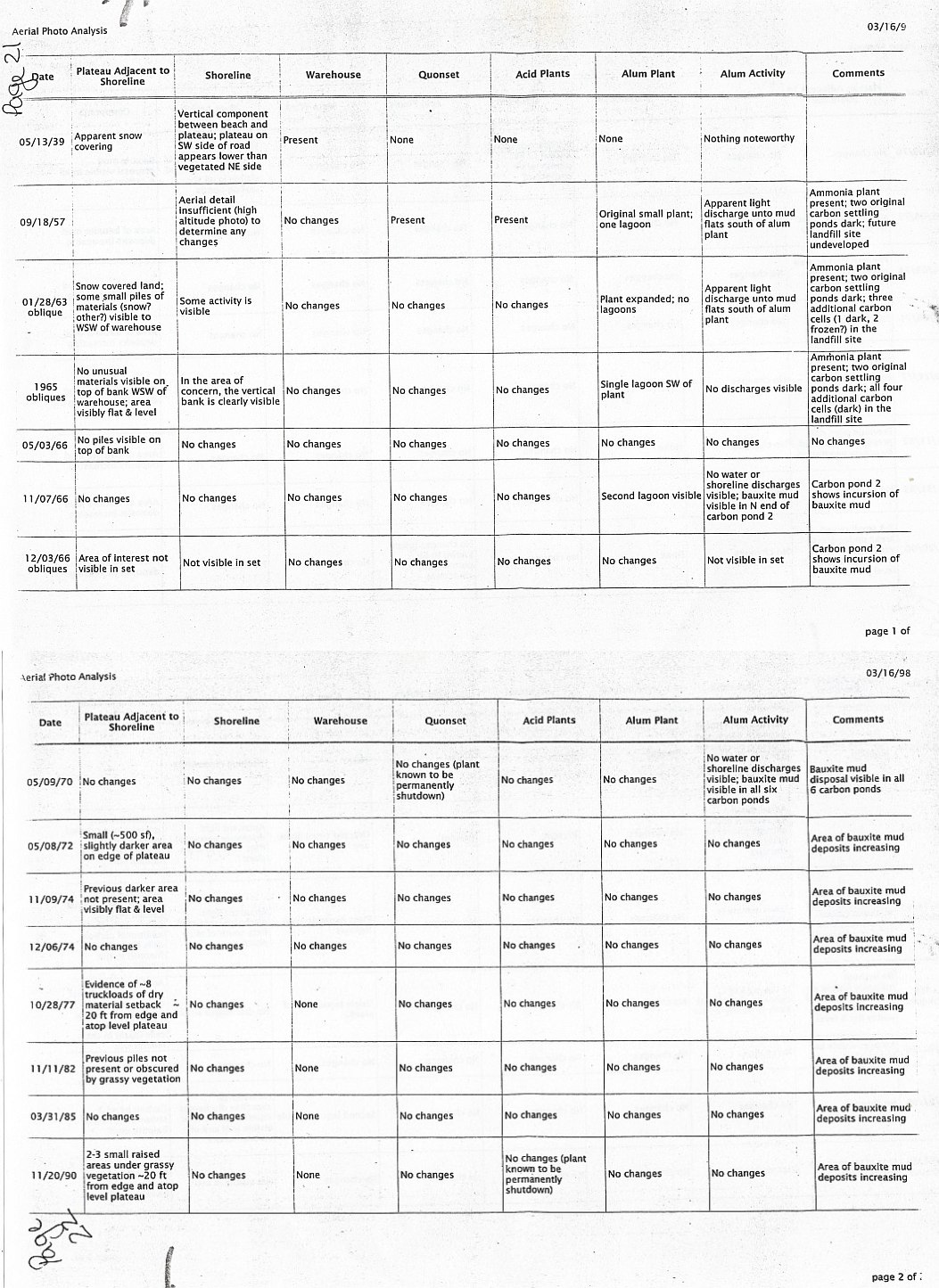
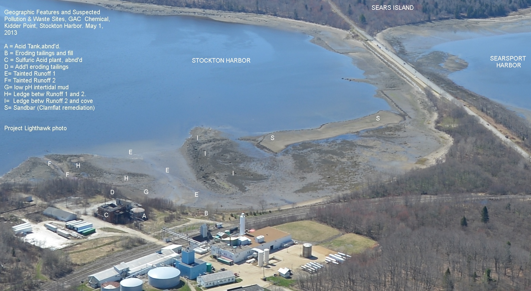
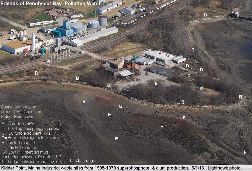
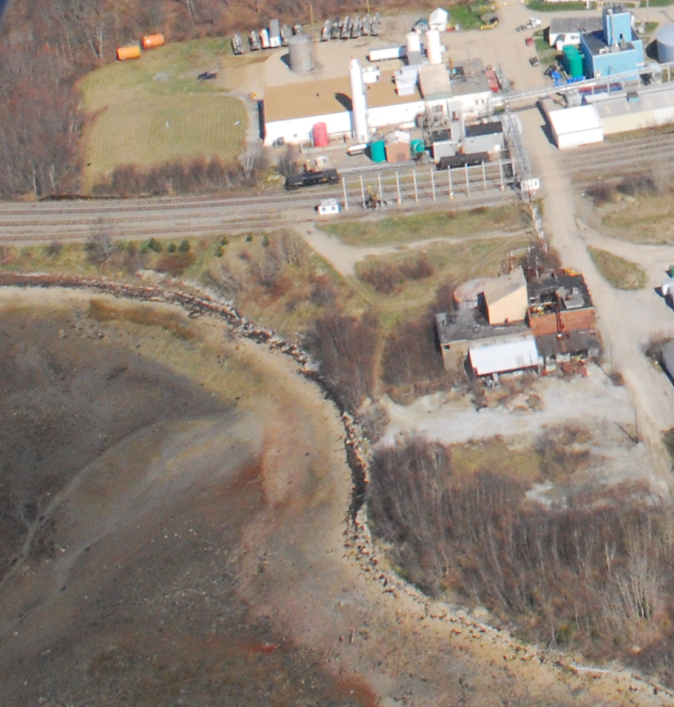
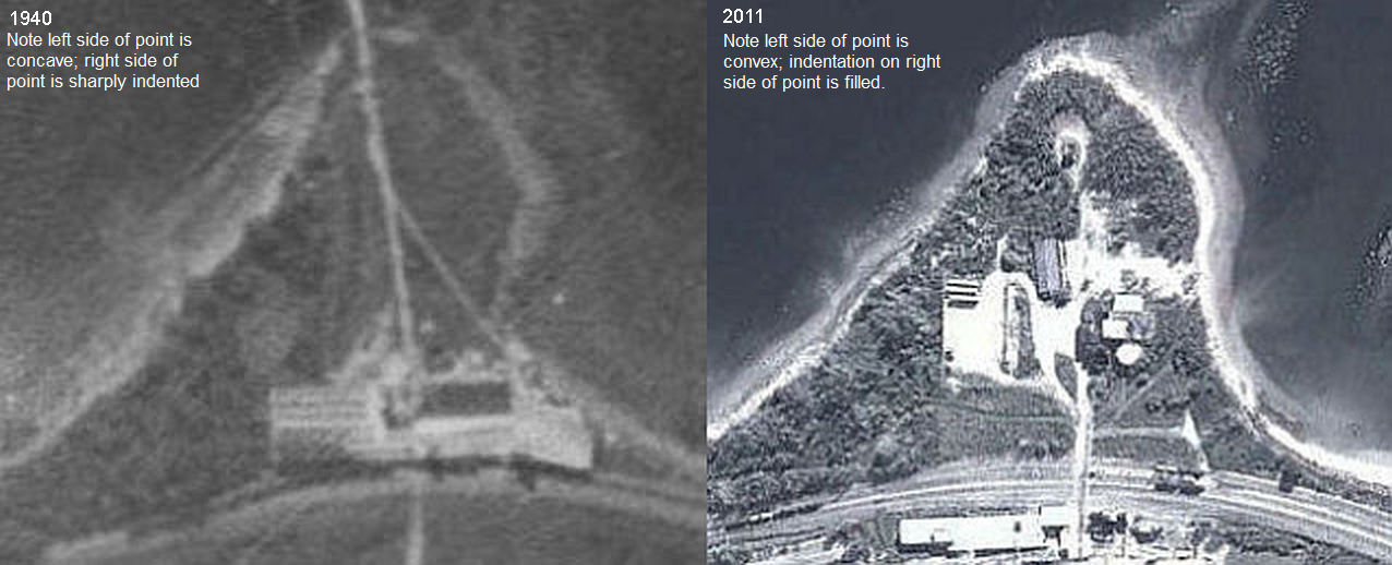 At Issue. Kidder Point's shore received thousands of tons of highly acidic waste laid down on wooden cribs during 30 years of superphosphate fertilizer production for Maine's potato industry, and alum production for Maine's paper industry. See expansion of the point into the harbor in aerial photos from 1940 and 2011. Wastes are up to 18 feet thick on the now rotting wooden cribs now lining the shore. Some wastes are mildly radioactive. Some acidic. Some alkaline. None should be eroding into Penobscot Bay.
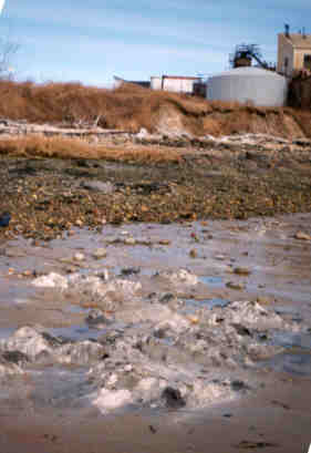
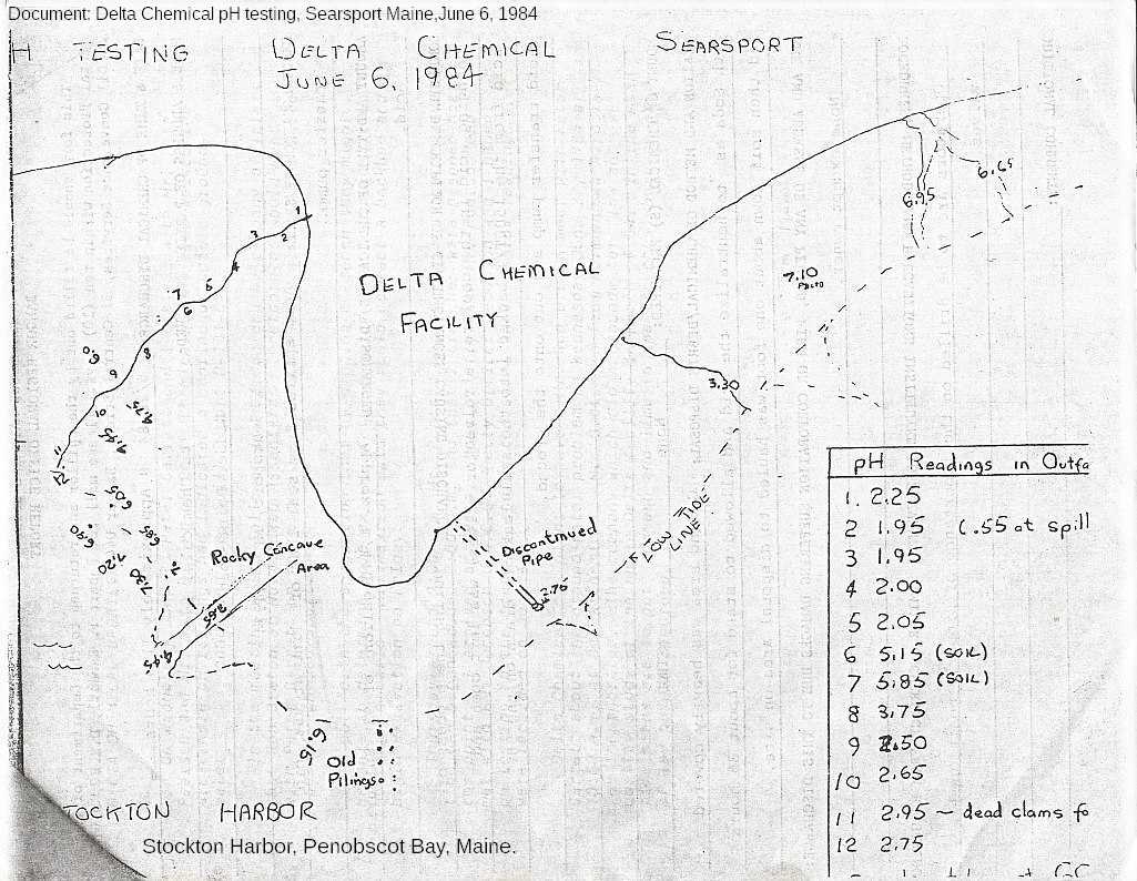
Failing containment cribs covering some of the shoreline dumps are allowing a large amount of phosphogypsum and bauxite to either erode directly from the waste onto the beach and flats or and leach into Kidder Point's shallow groundwater aquifer that flows into Stockton Harbor via intertidal seeps. This groundwater has high levels of sulfate and is very acidic due to 1984 spill from acid tank.
What needs doing?
(1) US EPA must declare the contaminated inner cove an imminent and substantial hzard to the public that needs to be dealt with immediately. This due to the excessive acidification of the beach and flat adjacent to the eroding wastes.The hundreds of tourists and local people touching shells, ceramic debris or sulfur rocks on the site or walking barefoot in the inner quarter of the cove experience skin irritation as well as localized numbness or "buzzing feeling" in hands and feet that have touched those waste-tainted materials onsite. This acidity is at a level that facilitates bio-absorbing aluminum, lead and other heavy metals known to be present in phosphogypsum and bauxite waste. While people and pets are at risk generally, children and unborn children are at particular risk.
(2) Carry out shoreline stabilization of the eroding slopes, to end the discharge of wastes into Stockton Harbor.
(3) Carry out intertidal dredging of the acre of flats that are most impacted and landfill the waste materials as appropriate.
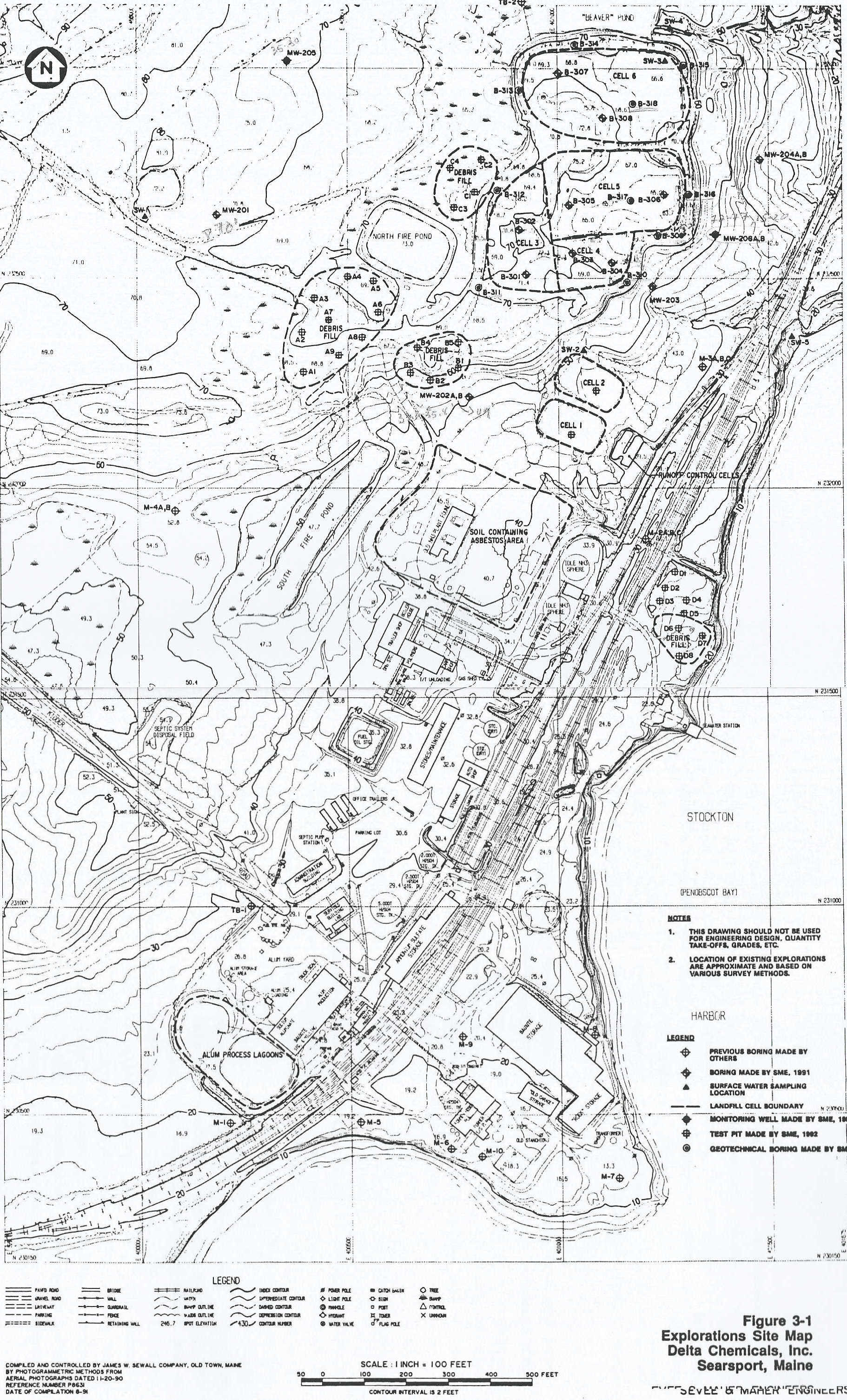
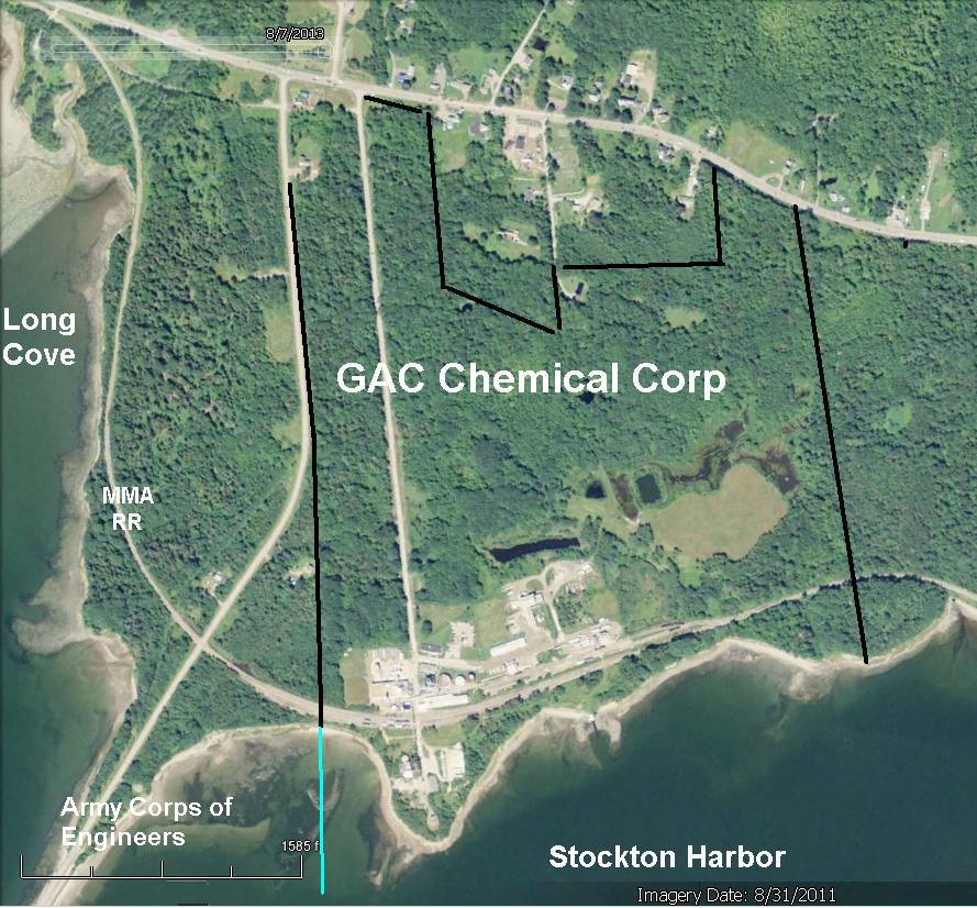
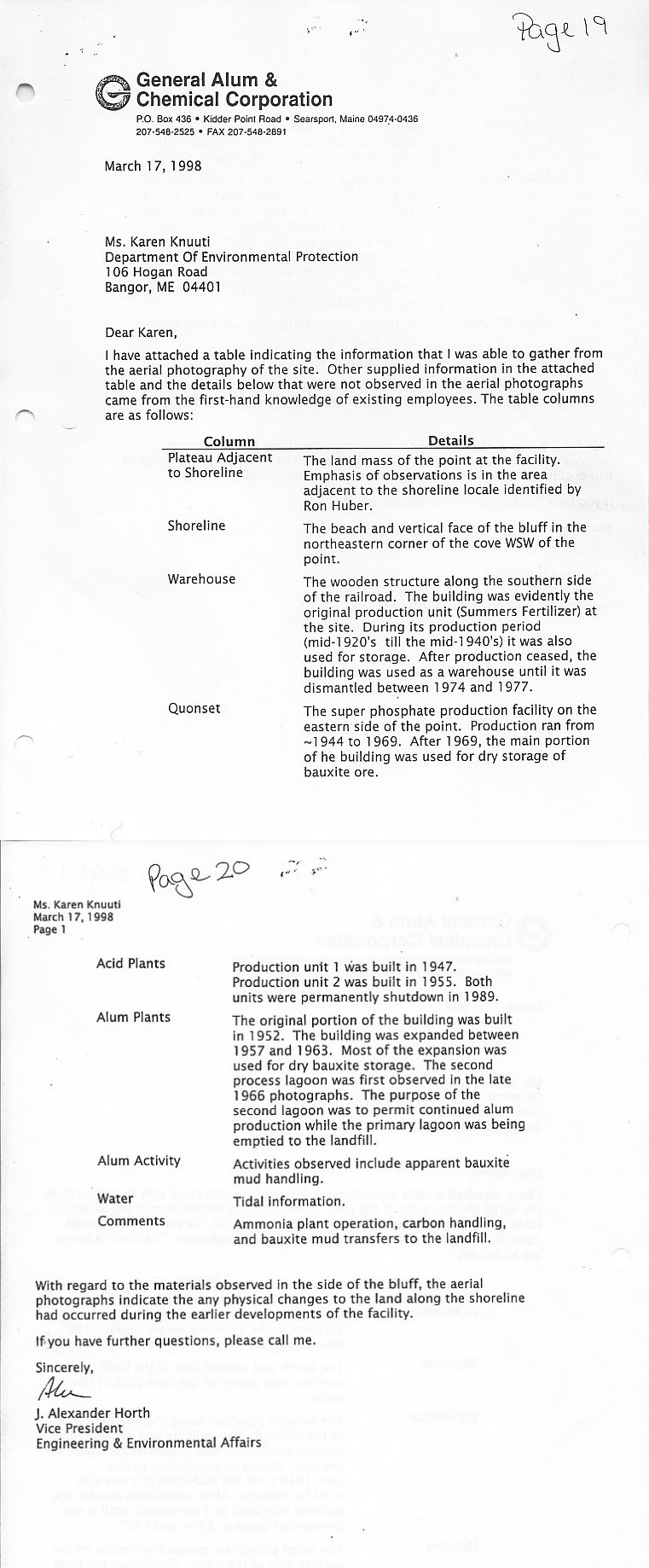
See News &reports from 1903 -1974 about this site & nearby Mack Point See a large 1993 map of then-Delta Chemical's waste sites and landfills .