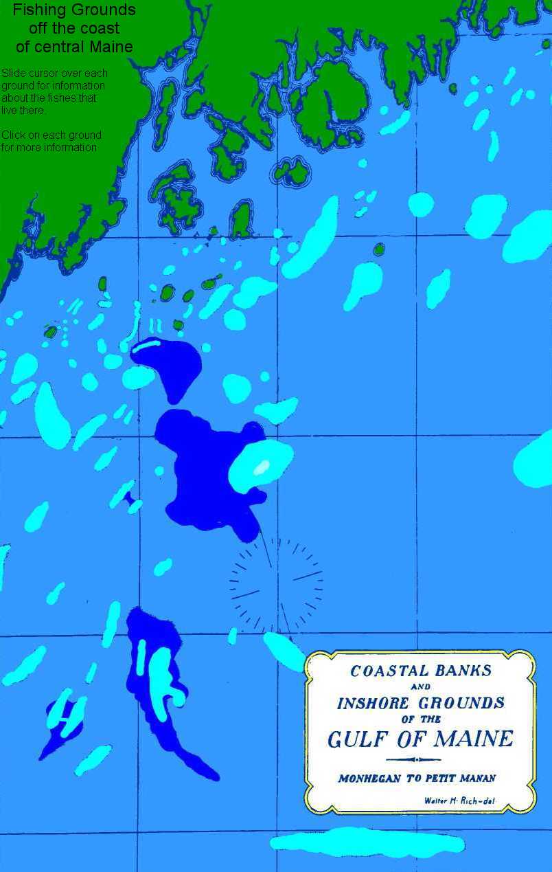
FISHING GROUNDS
OFF MIDCOAST MAINE
Visit 80 fishing grounds off the coast of Maine, from
Monhegan Island east to Petit Manan.
Fishing Grounds from east to west.
Middle Ridge.
Old Egg Rock.
Handspike Ground.
Western Egg Rock
Tibbetts Ledge
Bens Ground.
Mt Desert Inner Ridge.
Joe Ray Ground.
Southeast Rock.
Bakers Island Ridge.
Martins Ground; Hillards Reef.
Enochs Shoal
Abner Ground
Banks Ground.
Shell Ground.
Jones Ground.
Hake Ground.
Hatchell Ground.
Grumpy.
Blue Hill Ground.
Southwest Ground.
Western Reef; Otter Island Reef; Snipper Shin.
Inner Breaker.
Towhead Grounds.
Gravel Bottom and Southeast Ground
New Found.
Matinicus SouSouWest Grounds
New Found.
Western Ridge (or Green Island Ridge) and the Pigeon Ground.
The Bounties (The Bowdies)
Fippenies Ledge.
Maurice Lubees Ridge.
Fifty-five Fathom Bunch
Crie Ridges.
Gilkey Ground.
Barley Hill Ground.
Matinic Ooze.
Matinic Bank.
Freemans Ground.
Burnt Island, Outer Ridge.
Burnt Island, Inner Ridge aka Andrews Shoal
Franklin Ground.
Mosers Ledge aka Middle Ground.
Johns Head Ground
Skate Bank.
Haddock Nubble.
Minerva Hub.
Henry Marshalls Ground.
Bald Ridges.
Outer Shoal.
Monhegan Inner Sou' Southeast Ground
Harris Ground.
Monhegan Western Ground.
Monhegan Outer SouSouWest.
Harvey Blacks Ground.
Cashes Ridge East
A summer cod ground.
Newfound Ground.
Ornes Ground
A Hake Ground
Monhegan Inner SouSouwest Ground
Black Island Ground.
Middle Shoal, Pollock Rip, Allens Shoal, and Deckers Shoal.
Henry Gallants Ridges.
Monhegan SE.
Cod Ridge.
Toothaker Ridge.
John Dyers Ridge.
Cashes Ridge East.
Ridge east of Fippenies.
Big Ridge (Cashes Bank)
Cashes NW Ridge.
Blue Ground.
Outer Fall (also called Monhegan Fall)
Jeffreys Bank.
Inner Schoodic Ridge.
Outer Schoodic Ridge.
Bank Comfort.
Clay Bank.
First published as part of Appendix III to the Report of the US Commissioner of Fisheries for 1929. Bureau of Fisheries Doc # 1059. Submitted for publication Jan 18,1929.